Route 66 · Itinerary
Route 66 Finale: Arizona Desert to California Coast
A practical guide to exploring Route 66’s last leg, from Arizona’s roadside icons to the Santa Monica Pier’s ocean views.
Route 66 crosses eight states, but its final stretch is the one built for a dramatic finish. This five-day drive moves from desert caves and diner counters to a mining town with free-roaming burros, then across the open Mojave Desert to Palm Springs and the Pacific Ocean at the Santa Monica Pier. It’s neon nostalgia, Old West theater and desert solitude in one trip – the version of Route 66 that made the highway famous. And who doesn’t love a trip that ends at the beach?
Trip at a Glance
- Snacks and water – services thin out between Oatman and Amboy
- Cash for small-town vendors and cash-only shops
- Sun protection, even in cooler months – plus layers for nighttime temperatures that can drop sharply in the desert and along the California coast
- Comfortable, closed-toe shoes for uneven ground at Amboy Crater and around Oatman’s Main Street
- A downloaded offline map – cell coverage disappears for long sections of desert highway
Where You’ll Go
| Stop | Destination | Distance | Drive Time | Length of Stay | See & Do |
|---|---|---|---|---|---|
| 1 | Seligman, Arizona | First stop | First stop | 1 night | Grand Canyon Caverns, Delgadillo’s Snow Cap Drive-In, The Rusty Bolt, Route 66 Motoporium and Roadkill Cafe |
| 2 | Kingman, Arizona | 145 km | 2h | 1 night | Arizona Route 66 Museum, Hackberry General Store, Mr. D’z Route 66 Diner |
| 3 | Oatman, Arizona | 45 km | 1h | 1 night | Burros walking down Main Street, staged Old West gunfights, Oatman Hotel Restaurant & Bar, Main Street shops and vendors |
| 4 | Palm Springs, California | 370 km | 4h | 1 night | Roy’s Motel & Café in Amboy, Amboy Crater, Elmer’s Bottle Tree Ranch, Palm Springs’ Uptown Design District |
| 5 | Los Angeles & Santa Monica, California | 210 km | 2h 30m | 1–2 nights | Hollywood Walk of Fame, Rodeo Drive, Santa Monica Pier, Pacific Park |
Distance/drive time shown is the direct route into that stop from the previous one; plan extra time for stops along the way.
Before You Go: Tips for International Travelers
Driving & Rental Car Tips
A valid driver’s license from your home country is accepted for short-term rentals in Arizona and California, though many rental companies also recommend carrying an International Driving Permit (IDP) alongside it, especially if your license is in non-Latin characters. Renters typically must be at least 21 years old, and you usually need a major credit card for the deposit. U.S. traffic moves on the right-hand side of the road and speed limits are posted in miles per hour, not kilometers. Gas stations can be more than 80 kilometers apart between Oatman and Amboy, so fill up whenever the tank drops below half.
Time Zones
- Arizona stays on Mountain Standard Time year-round and does not observe Daylight Saving Time.
- California observes Pacific Time with Daylight Saving Time.
- For part of the year, the two states are effectively on the same clock, and for the rest of the year they’re an hour apart, so double-check when timing reservations near the state line.
Tipping
Tipping is customary and expected in the United States. For sit-down restaurant service, 18–20% of the pre-tax bill is standard. Hotel housekeeping is generally tipped a few dollars per night, left in the room, and bellhops are typically tipped a couple of dollars per bag.
Lodging Options
This route runs through small towns, so options range from classic Route 66 motor motels in Seligman and Kingman to resort hotels in Palm Springs and Los Angeles. Book Oatman-area or Bullhead City lodging and Palm Springs hotels ahead of time on fall and spring weekends, when both fill up quickly.
Tolls & Navigation Tips
This itinerary follows Interstate 40, Interstate 10 and historic U.S. Route 66, with no toll roads required, so travelers won’t need a toll transponder or cash for tolls. A handful of express lanes exist in the Los Angeles area, but GPS apps will flag these and offer a free alternative. Cell coverage is unreliable across the Mojave Desert between Oatman and Amboy, so download offline maps in advance.
Find more information on U.S. Visa & Entry.
Stop 1 · Day 1
Seligman, Arizona
Home to the Route 66 revival, this is where the Mother Road’s second life began.
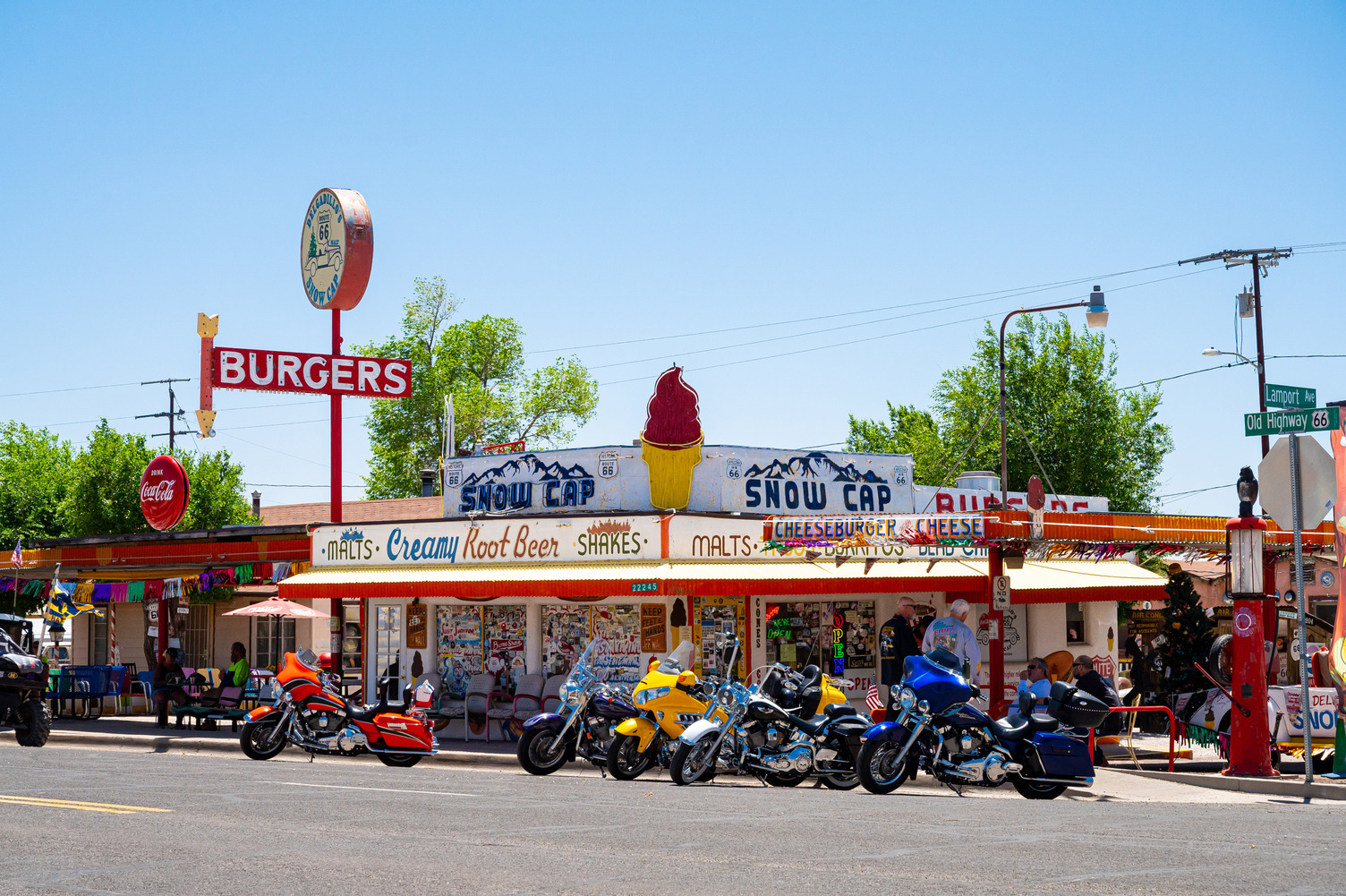
Seligman is where Route 66 nostalgia was saved from extinction. When Interstate 40 bypassed the town in 1978, local barber Angel Delgadillo rallied residents to preserve the historic road, a campaign that eventually led to Route 66 being designated Arizona’s first historic highway. That spirit still drives the town’s compact main street, lined with vintage motor courts, hand-painted signs and gift shops that feel unchanged since the 1950s. On the way into town, detour a short drive to Grand Canyon Caverns, where an elevator drops visitors more than 60 meters into a dry limestone cave system for a 45-minute guided tour – a cool break from the desert heat, since the caves stay around 13 degrees Celsius year-round. Back in town, Delgadillo’s Snow Cap Drive-In, opened by Angel’s brother Juan in 1953 and still run by the family, serves up burgers, shakes and practical jokes with every order. Turn in for the night early – the road to Kingman is one of the longest surviving original alignments of Route 66 and it’s worth driving during daylight.
See
- A restored 1926 barber chair at Angel & Vilma Delgadillo’s Original Route 66 Gift Shop
- Vintage-packed storefronts at The Rusty Bolt & Route 66 Motoporium
- Neon signs along Seligman’s main strip
Do
- Take the 45-minute cave tour at Grand Canyon Caverns
- Browse Seligman’s Route 66 gift shops
- Photograph classic cars parked around town
Eat
- “A Cheeseburger with Cheese” from Delgadillo’s Snow Cap Drive-In
- World-famous carrot cake from Westside Lilo’s Cafe
- Buffalo burgers and a menu full of Route 66 puns at Roadkill Cafe
Stop 2 · Day 2
Kingman, Arizona
Wander a historic railroad town on the longest surviving section of Route 66.
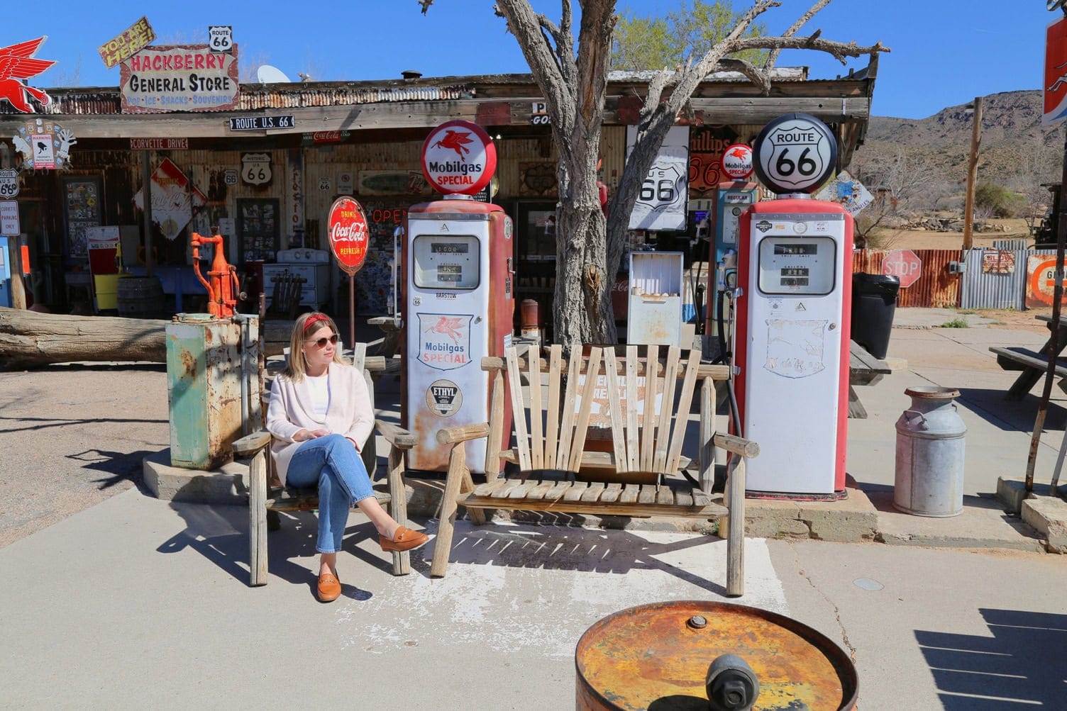
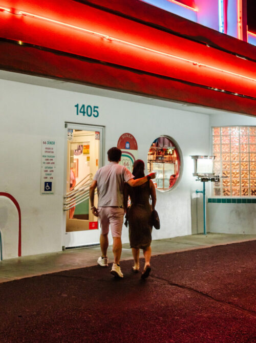
Kingman grew up as a railroad and mining supply town and today it’s the largest city on this part of Route 66. Start with lunch at Mr. D’z Route 66 Diner, a candy-colored 1950s-style diner known for root beer floats and monster burgers that 2 or 3 people can share. From there, the Arizona Route 66 Museum, located inside the Powerhouse Visitor Center, covers the road’s full history in the state, from wagon trail and Dust Bowl migration route to postwar tourist corridor. Stop by Hackberry General Store, one of the most photographed roadside stops on the highway. The former gas station now serves as a museum and gift shop, with vintage cars, gas pumps and hand-painted signage lining its exterior. Cap the day with dinner at Garibaldi’s, a Kingman institution for Italian comfort food, before settling in for a good night’s rest. Tomorrow’s drive over Sitgreaves Pass is the trip’s most dramatic route.
See
- Arizona Route 66 Museum
- Historic Beale Street storefronts
- Hackberry General Store
Do
- Explore the Route 66 murals downtown
- Browse the museum’s vintage vehicle collection
- Photograph Hackberry’s roadside display
Eat
- Bacon cheeseburger and root beer float from Mr. D’z Route 66 Diner
- Fried ravioli from Garibaldi’s
- Pressed paninis from Sirens Cafe
Stop 3 · Day 3
Oatman, Arizona
Be charmed by this gold-rush ghost town where burros outnumber the crowds.
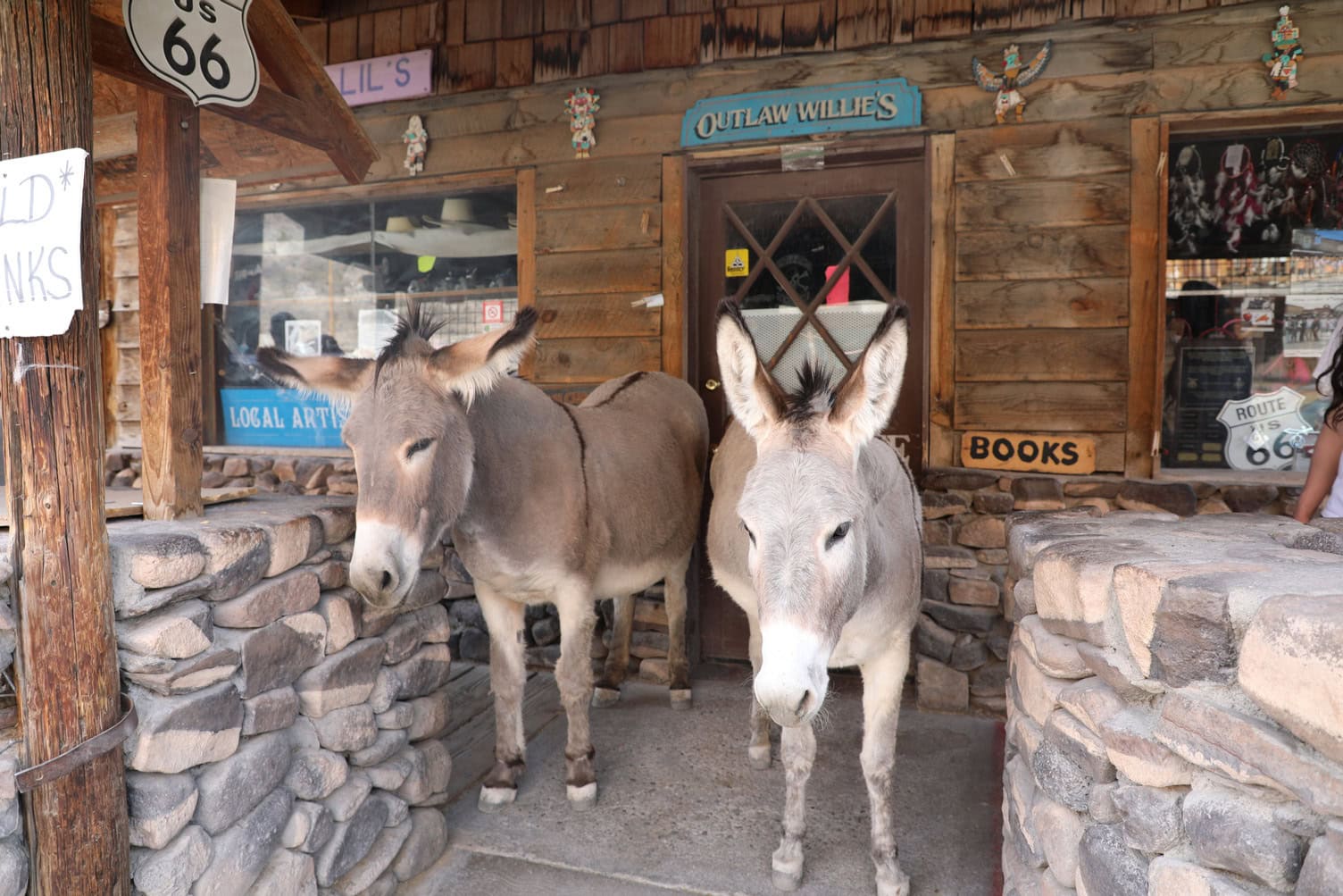
Oatman boomed as a gold-mining camp in the early 1900s, with over 10,000 residents and $36 million in gold pulled from the hills. When the mines closed and Route 66 bypassed the town in the 1950s, it nearly became a ghost town within a decade. It survives today as a working tourist stop, most famous for the burros that walk through Main Street – descendants of pack animals turned loose by miners a century ago. Arrive before 11 a.m. to beat the midday crowds and heat. Pick up approved burro feed from local shops if you’d like to meet Oatman’s famous four-legged residents.
When it’s your turn to eat, stop by the Oatman Hotel Restaurant & Bar for a hearty and historic lunch inside an adobe building from 1902. Stick around Main Street to catch one of the staged Old West shootouts performed by the “Oatman Outlaws” gunfighter troupe. Many vendors here are cash-only, so come prepared if you wish to shop. Spend the night in Oatman or nearby Bullhead City so you can get an early start on tomorrow’s long Mojave Desert drive.
See
- Free-roaming burros
- The historic Oatman Hotel
- The Oatman Jail Museum
Do
- Watch staged gunfights
- Feed the burros with food purchased locally
- Browse Main Street’s vendors and shops
Eat
- “Burro Ears” from Oatman Hotel Restaurant & Bar – uniquely shaped homemade fried potato chips paired with salsa and sour cream
- Bear claw pastries from Black Bear Diner in Bullhead City
- Topock 66 Breakfast Burrito on the way to your next stop
Stop 4 · Day 4
The Mojave Desert to Palm Springs
Cross into California for volcanic craters, roadside art and mid-century desert glamour.
From Oatman, Arizona, continue on old Route 66 to Topock and cross the Colorado River into California near Needles. Watch out for the Old Trails Bridge and welcome murals marking the start of the Mother Road’s final state. Fill up in Needles, since the next reliable gas is an hour away, then follow the National Trails Highway toward Amboy. This is the most remote day of the trip, with long stretches between services, but it’s also the most photogenic. You’ll want to slow down for Roy’s Motel & Café. This nearly abandoned motor court is a classic example of Googie architecture, the atomic-age, space-and-motion inspired style that defined mid-century American roadside design. Its iconic boomerang neon sign has become one of the most photographed landmarks on Route 66. A short walk away, Amboy Crater is a dormant volcanic cinder cone roughly 5,000 years old.
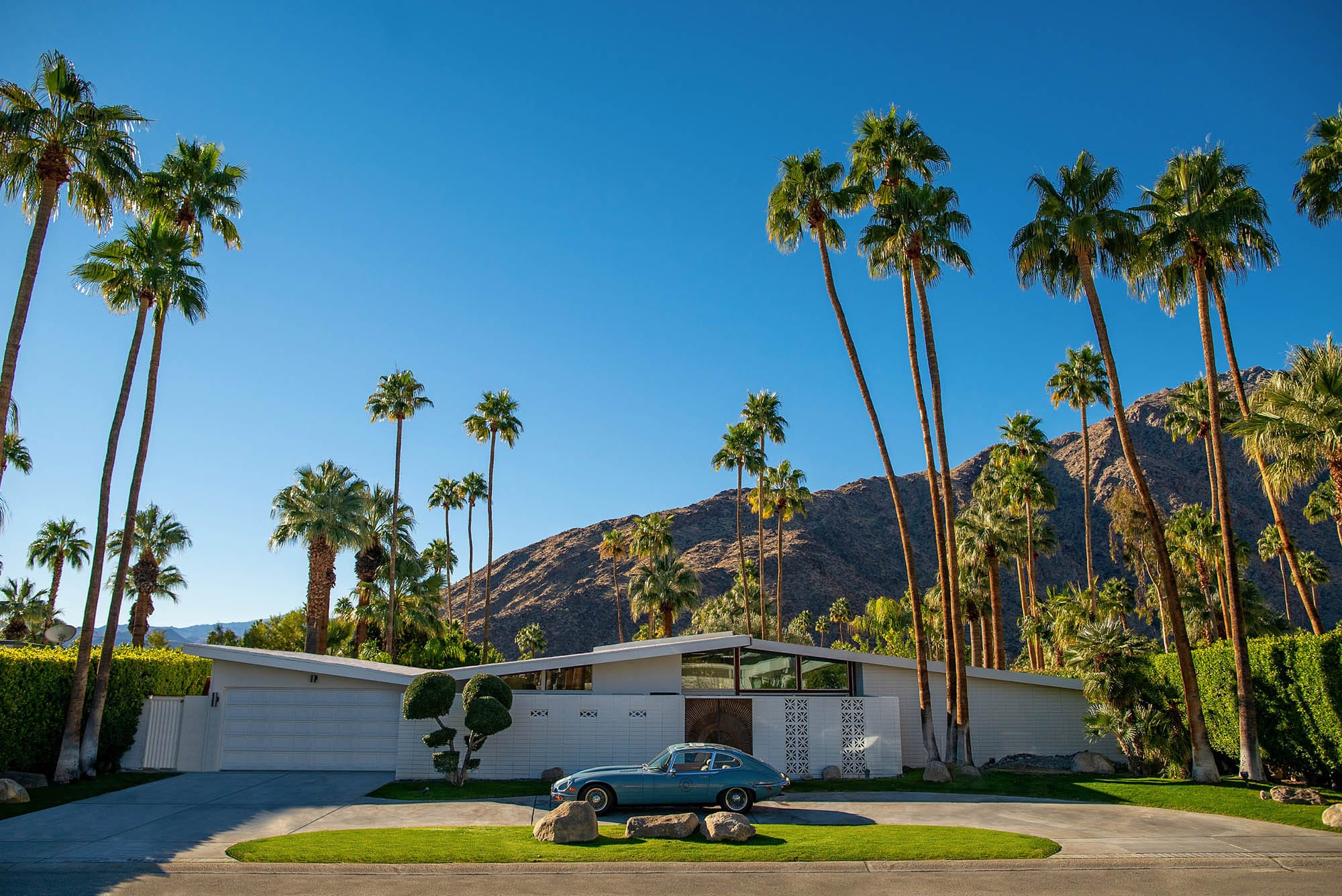
Continuing west, Elmer’s Bottle Tree Ranch near Oro Grande is a free, donation-supported roadside art installation of hundreds of “trees” built from steel pipe and vintage glass bottles. From there, head south to Palm Springs, the desert resort town that became a mid-century playground for Hollywood, known today for its walkable downtown, boutique shopping and palm-lined streets. Its Old Las Palmas neighborhood, once home to stars like Frank Sinatra and Elvis, remains one of the best-preserved collections of Modernist homes from that era. Go on a stroll through its scenic streets before dinner, then stay overnight at one of the town’s resort-and-spa properties. Tomorrow’s drive leads to Los Angeles – best started with an early lunch on the road.
See
- Roy’s neon boomerang sign – extra stunning at night
- Amboy Crater’s volcanic cinder cone
- Elmer’s hundreds of bottle-trees
Do
- Ride the Palm Springs Aerial Tramway for desert-to-alpine views
- Spot mid-century modern homes on a self-guided tour through the Old Las Palmas neighborhood
- Soak in a spa treatment or resort pool in Palm Springs
Eat
- Fluffy pancakes on the patio at Norma’s
- Corned beef sandwiches from Sherman’s Deli & Bakery
- Cinnamon rolls from Billy Reed’s
Stop 5 · Day 5
Los Angeles & Santa Monica, California
Soak in Hollywood glamour and Pacific Ocean beauty at the official end of the route.
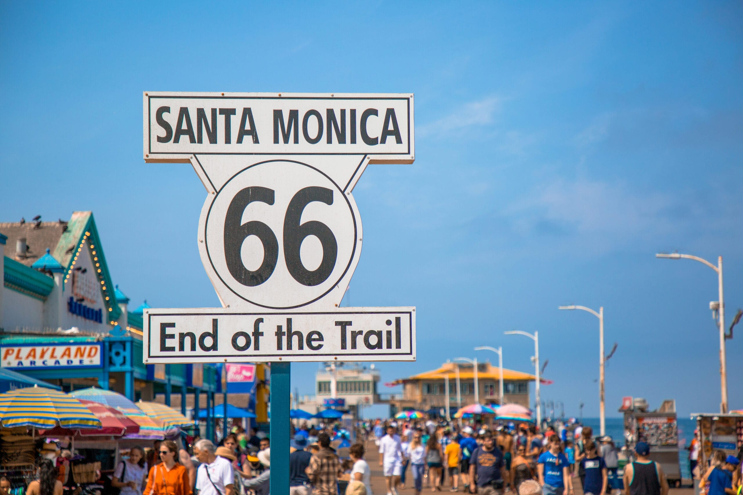
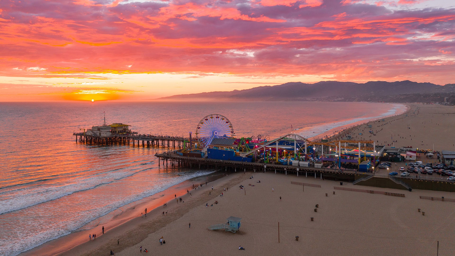
Once in Los Angeles, hit two of its most famous landmarks: the Hollywood Walk of Fame, with its thousands of bronze stars honoring entertainment figures, and Rodeo Drive in Beverly Hills, the three-block strip of luxury flagship stores that’s as much a sightseeing destination as a shopping one. Save the finale for the Santa Monica Pier, the symbolic western end of Route 66, marked by a sign reading “Route 66 – End of the Trail.” Walk out over the Pacific, ride the solar-powered Ferris wheel at Pacific Park and watch the sun go down over the ocean before a celebratory dinner at The Lobster, prized for its fresh seafood and pier-front views. Fly out of LAX the next morning, or extend the trip north on the Pacific Coast Highway.
See
- Hollywood Walk of Fame
- Rodeo Drive
- The “End of the Trail” sign at Santa Monica Pier
Do
- Ride the rides at Pacific Park
- Walk the length of Santa Monica Pier
- Browse Rodeo Drive’s storefronts, even if just window-shopping
Eat
- Patty melt or huevos rancheros at Mel’s Drive-In
- Signature steamed Maine lobster or charred octopus served at The Lobster
- Star-studded Chinese food from The Formosa Cafe
Ready for the Open Road?
Review common traveler questions, then start mapping your own Route 66 journey.
More Trip Ideas